
Description of the parish
General introduction
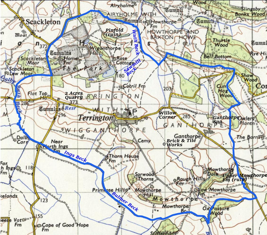
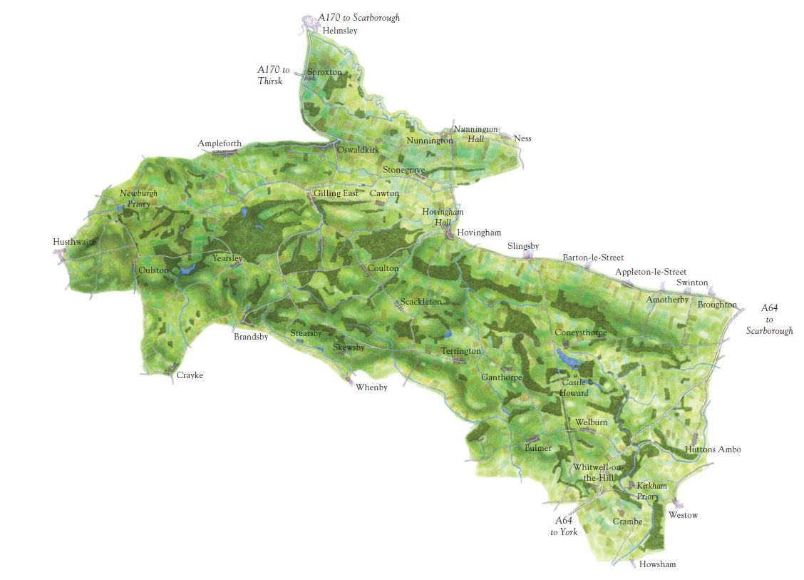
Terrington is a rural parish about 15 miles north of York, 8 miles west of Malton, and 3 miles west of Castle Howard. It lies in the Howardian Hills Area of Outstanding Natural Beauty (AONB), which covers an area of 79 square miles of well-wooded rolling countryside between the North York Moors National Park, the Yorkshire Wolds, and the Vale of York. It is surrounded by the civil parishes of Hovingham with Scackleton, Coneysthorpe, Henderskelfe, Bulmer, Sheriff Hutton, Whenby, and Dalby-cum-Skewsby. The parish has an area of about 6 square miles and extends about 3 miles from north to south and similarly from west to east. There are around 250 dwellings and in the 2011 census the population was 459. The lowest point, along Ings Beck, is 35m (115ft) above sea level and the highest point, Bawdy Hill just to the west of the main village, is 108m (354ft) above sea level.
The underlying rocks are Jurassic sandstones and limestones. Many of the buildings in the village are built of stone from a quarry in the parish on the Dalby Road. The parish is bounded to the south by Ings Beck and Bulmer Beck, to the west partly by Dalby Bush Beck, and to the north partly by Wath Beck. The Ebor Way and Centenary Way long-distance footpaths pass through the village.
The village is within the Thirsk and Malton UK Parliament constituency. It is also within the Hovingham and Sheriff Hutton electoral division of North Yorkshire County Council and the Hovingham ward of Ryedale District Council.
© Howardian Hills AONB Partnership
Reproduced here with permission
The Main Street of the village runs from west to east with Back Lanes to the north and south. The main street is sheltered in a valley just to the north of the southern ridge of the Howardian Hills, with the church on slightly higher ground at the eastern end of North Back Lane. There is a triangular green area (The Plump) at the western end of the main street. Many of the buildings are of local stone with red pantile roofs.
As well as about a dozen outlying farms, there are three satellite settlements all with names of Viking origin: Mowthorpe to the south-east of Terrington village has five scattered farm-houses, Wiganthorpe (or Wigganthorpe) to the north-west has a residential heart of some dozen or so dwellings, and Ganthorpe to the east, once its own civil parish, has a large house, a few cottages and three farms.
In 1752 much of the village of Terrington and Ganthorpe and their lands were bought by the Howards, Earls of Carlisle from Lord Downe and from then until the present day they have had strong associations with the Castle Howard Estate. The open fields and commons of Terrington were enclosed by private Act of Parliament of 1772 with most of the land going to the Earl of Carlisle. The Castle Howard Estate still owns land and houses in the parish.
The church of All Saints is the oldest building in Terrington. It has some pre-Conquest 11th century remnants, most noticeably a wall with herring-bone pattern stonework. The churchyard contains the grave of one of the parish’s most illustrious sons, Richard Spruce, an important Victorian explorer and botanist.
The oldest existing houses are believed to date from the eighteenth century and were probably originally thatched. Significant houses include: Wiganthorpe Hall, designed by John Carr but mostly demolished in 1956; Cliff Hall, built about 1870; Terrington Hall, a fine Georgian building, built in 1827 as the rectory and now a private school; and Ganthorpe Hall, a fine Georgian building.
Primary education is provided at Terrington Church of England Primary School, and Terrington Hall Preparatory School caters for boys and girls aged 3 to 13, with a mixture of boarders and day pupils.
The village has a number of small businesses, a shop and cafe, a lavender farm, and a mobile post office, but the Bay Horse pub closed in 2011. A social hub is provided by the modern Village Hall with sports field, tennis courts and children's playground.
Information from censuses and other sources allows us to trace the story of an agricultural and largely self-sufficient community in the 19th century and early 20th century, with a preponderance of agricultural workers and about 15, mainly tenant, farmers, its shoemakers, tailors, stonemasons, joiners, Methodist chapels, shops, post office and pubs. Much is different about the village today but much has remained the same and some has even returned.