
Walks and footpaths in the parish
New bridge over Sawmill Beck
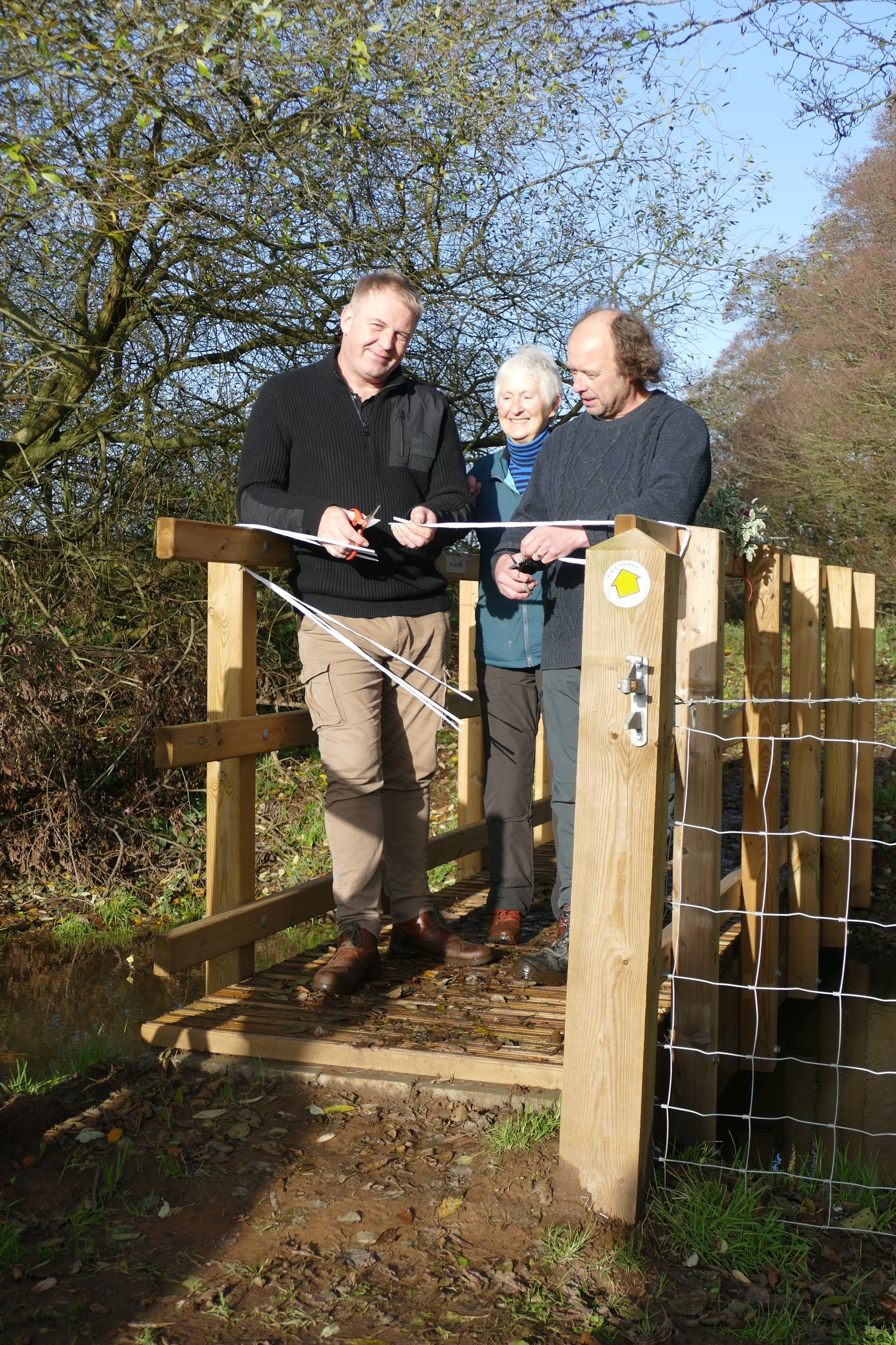
A new bridge has been opened in Terrington – thanks to local residents.
North Yorkshire County Councillor Steve Mason cut the ribbon on the village’s new Platinum Bridge over Sawmill Beck at a ceremony attended by local councillors and residents.
Parishioner Jane Hanstock highlighted the importance of the bridge after the former bridge collapsed. She said: “After the bridge collapsed into the beck, the whole footpath on which it stood had been forced to close, depriving residents and visitors alike of a very popular circular footpath from the village, one which had contributed immensely to physical and mental wellbeing in the periods of lockdown during Covid.
“I brought the importance of the bridge to the attention of North Yorkshire’s Footpaths Team and subsequently initiated a fruitful collaboration between North Yorkshire County Council and Terrington Parish Council who provided some of the funding.
“The result was that after some 18 months of discussions and negotiations the new bridge was installed.”
Field Officer Andrew Hall undertook all the practical work, working with landowners and making sure that the siting and design of the new bridge were even better than what has gone before.
It has been decided to name it the Platinum Bridge to mark the year in which it was erected.
Jane added: “Terrington already has a Coronation Clump of trees, dating back to at least the coronation of Queen Victoria in 1838 and maybe even to that of one of her predecessors. The hope now is that the new bridge will last as long!”
On Friday 25 November 2022, Cllr Steve Mason, North Yorkshire County Councillor of Amotherby and Ampleforth division, together with Andrew Hall, North Yorkshire Public Rights of Way Field Officer, opened the new bridge at a special ceremony.
Cllr Mason said: “As councillor within one of the most beautiful places in the country, I’m never disappointed by hidden gems of walks such as this. The team in Terrington have delivered such a beautiful asset to the village for all the enjoy.
“It was one of the highlights of my first year as councillor to be invited.”
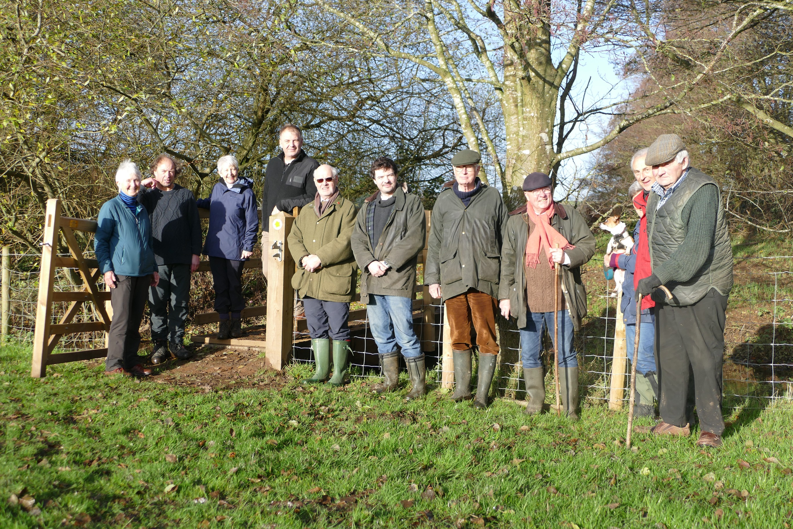
Picture: Keith Adkins
Rights of way
This map shows public rights of way (footpaths and bridleways) in the parish.

A map of all footpaths and bridleways in North Yorkshire, with footpaths and bridleways shown in different colours, is available at North Yorkshire public rights of way. This is a very large file which takes a little time to download as it covers the whole county, but you can zoom in to Terrington to see a very detailed Ordnance Survey map.
Guides to circular walks
There are several walks in the parish and other walks in the Howardian Hills on the Howardian Hills AONB web site - Walking.
Walk 3 has now been reinstated following the bridge renewal and is available here: Terrington Walk 3.
Accessible Trails
See the Howardian Hills AONB web site - Accessible Trails for Easy Countryside Trails.
Long-distance paths
Two long-distance paths pass through the parish, Centenary Way and Ebor Way.
Centenary Way
This was created in 1989 to celebrate the 100th anniversary of the North Riding County Council (which became, with some losses, North Yorkshire County Council in 1974). The path runs for 82.6 miles from Filey Brigg to York Minster. Locally, it runs from Howthorpe Farm through Terrington, along Mowthorpe Lane to Birkdale Farm, and from there to High Stittenham.
See the Long Distance Walkers Association website - Centenary Way for references and the GPS Cycle and Walking Routes website - Centenary Way for route details and maps.
Ebor Way
This runs for 75.7 miles from Helmsley, where it connects with the Cleveland Way, to Ilkley, where it connects with the Dales Way. Locally, it runs from Howthorpe Farm through Terrington to Primrose Farm and on to Sheriff Hutton.
See the Long Distance Walkers Association website - Ebor Way for references and the GPS Cycle and Walking Routes website - Ebor Way for route details and maps.
Cycling and Riding Routes
See the Howardian Hills AONB web site - Riding for cycling and riding routes.